Geology of the Okanogan Highlands 2011
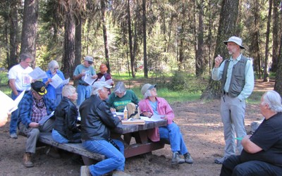
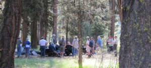
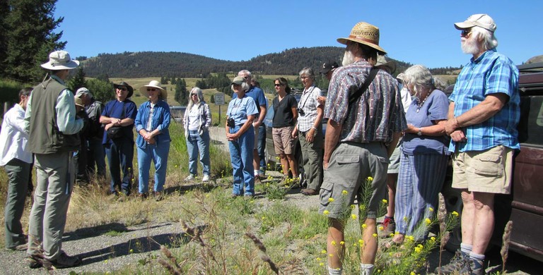
On August 6th, 2011, Ralph Dawes led a caravan tour highlighting the geology of the highlands. You can use this webpage to learn about what we saw, or even go on the tour on your own, using the information found here.
The tour started at Lost Lake with an introduction to geology and the geologic history of the highlands.
Says Dawes, “I love learning, teaching, and sharing geological experiences because the planet we live on is, in its own way, a living, breathing entity, with its own distinctive characteristics and patterns, and its own history.”
Dawes describes the event beforehand: “We will consider the exotic history of the older rocks of the Okanogan Highlands, which came on a moving plate from across an ancient ocean and then were buried and partly melted in the Earth as they became part of the North American continent. It will also give us chance to appreciate the amazing effects of the glaciation of the Highlands, moving ice, thousands of feet thick, which melted away not much more than 10,000 years ago and left the Highlands landscape sculpted away in some places and sprinkled with glacial droppings everywhere else. It is on this template that the modern lakes, streams, wetlands, fauna, and flora have established themselves and found their niches, and drawn all of their minerals and some of their energy. There will be lots of things to look at, think about, and make connections among as we explore its geology and how its geology connects with Earth history and other Earth systems.”
Born in Edmonds, WA, Ralph Dawes has a PhD in Geology at University of Washington. He is married to Cheryl Dawes, who happens to have a BS in Geology. They now live east of the Cascades and love it because the rocks are so much better exposed! Ralph Dawes teaches geology and other Earth sciences at Wenatchee Valley College in Wenatchee.
If you would like to follow this tour on your own, start at the Lost Lake campground parking lot and if your vehicle has a trip meter, set it to “zero.” Use the information on the following pages to conduct your tour. Or, for an online tour, simply click on the pages below, which correspond with the stops.
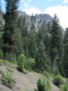
Stop 1
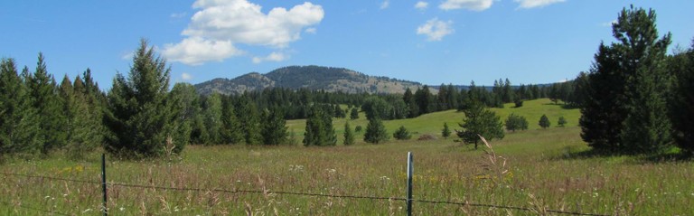
Take Myers Creek road toward Chesaw. 3.5 miles from the Lost Lake parking lot, the first stop offers a view of Buckhorn Mountain (above, looking Northwest) and other features of the terrain.
Stop 2
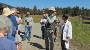
Continue along Myers Creek road for 2.2 miles from the last stop; the second stop is at the Pine Chee wetland, at the corner of Myers Creek Road and Chesaw Road.
Just before the Pine Chee wetland, you will see an outcrop on the righthand side of the road. This outcrop shows rock from a lava flow — andesite, a common volcanic rock — which contains feldspar, and a dark green/black, square shaped pyroxene. The outcrop is similar enough to nearby volcanic rocks that have been measured, that it is thought to be about 50 million years old (Eocene epoch age). Dawes explained, “This can be recognized as volcanic rock in several ways: it doesn’t have sedimentary-type bedding layers in it; it’s not composed of all big, visible crystals throughout like a granite has; and the white crystals in it have a nice crystal form with square and sharp corners.”
Stop 3
Turn right onto Chesaw Road…
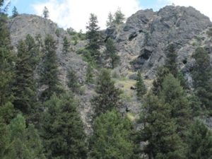
Stop 4
Continue along Chesaw Road for 1.4 miles until you see a pull-out on the right. Stop 4 provides a dramatic outcrop of accreted terrane, with metamorphic rock that is still somewhat layered…
Stop 5
Continue along Chesaw Road and turn left on Toroda Creek Rd. When you have gone 13.3 miles since Stop 4, look for a pull-out on the right. Stop 5 was passed by the caravan tour due to time constraints, but has some interesting outcrops that are worth looking at. Feel free to email OHA if you have comments about this location to add to this page.
Stop 6
Continue along Toroda Creek Road for 1.5 miles and turn left onto Nicholson Creek Road…
Corkscrew Mountain Update: Since the field trip, Dr. Dawes conducted some literature research on Corkscrew Mountain. The only geologic publication on Corkscrew Mountain he has found is by Robert C. Pearson of the United States Geological Survey, published in 1988 in the Geological Society of America Abstracts with Programs (volume 20, number 6). Page 462 provides, “The Geotectobolt-Helical Structure in an Eocene Volcanic Pipe, northwestern Ferry County, Washington, or, Screwed Up Again.” This publication is a partly tongue-in-cheek short article in which Pearson interprets the origin of the steep, twisting layers of volcanic rock on Corkscrew Mountain, which are Eocene in age, about 40-54 million years old. He interprets those corkscrewing rock layers as having formed in the side of a volcanic “pipe,” a conduit leading up into a volcanic crater. Dr. Dawes is exploring the possibility of interpreting this geologic feature himself and will keep OHA posted on the results.
Stop 7
Suggested resources:
- Northwest Exposures: A Geologic Story of the Northwest by David Alt and Donald Hyndman
- Roadside Geology of Washington by David Alt and Donald Hyndman, Mountain Press Publishing (Missoula, Montana), ISBN 078-0-87842-160-2
- The Roadside Geology series of books also includes other states that may be of interest
education, events, field trip, geology, highland wonders, rocks