Water Quality Contamination
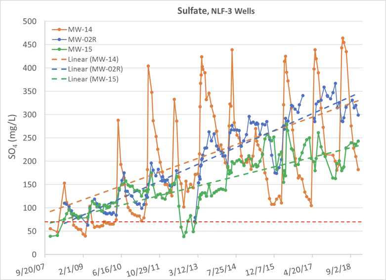
The red dashed line in the above graph shows the allowable (2014 permit) level of sulfate. The other dashed lines show the general trend of sulfate levels in various monitoring locations.
These monitoring wells are located in a fault downgradient from the mine, just outside the capture zone, which is supposed to capture all mine contaminants. Sulfate concentrations in all these monitoring wells (MW) are still increasing. Many values in MW-14 and MW-2R even exceeded the State groundwater standard (250 mg/L — a much higher level than the 69.5 mg/L allowed by the permit). Although MW-14, which is closest to Gold Bowl Creek, had the highest peak concentrations, the recent overall trend in that well could be decreasing slightly.
The trendlines shown above include sampling that occurred during “injection testing” of well MW-2R in the summer and fall of 2012, which involved injecting treated (clean) water into the well. This dilution caused monitoring to show a misleading decrease in sulfate concentrations in a nearby well.
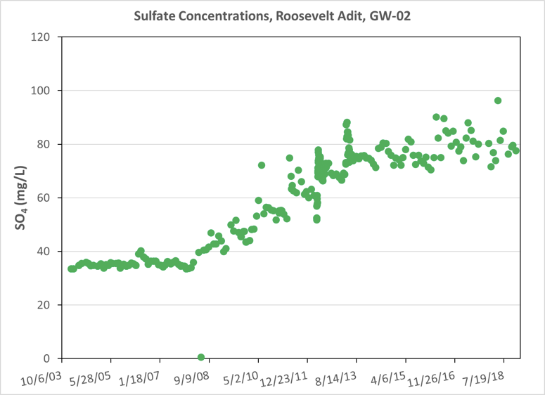
The Roosevelt Adit (shown in the graph above) is considered a surface water monitoring location. The permit limit for surface water outside the capture zone is 72 mg/L. Sulfate concentrations were consistently ~35 mg/L before mining began in 2008. After that point, sulfate concentrations began to rise and exceeded the current permit limit for the first time in June 2010. All results have been above the permit limit since February 2016, with the exception of one measurement in February 2018. While concentrations have been leveling off in the last two years, they also reached their highest point in early May 2018, still above the allowable level.
At the end of closure, dewatering will stop, and the capture zone will no longer exist. When that occurs, Ecology should be clear that all water on the site, including areas inside the former capture zone, will be required to meet discharge permit limits.