
Tag: restoration

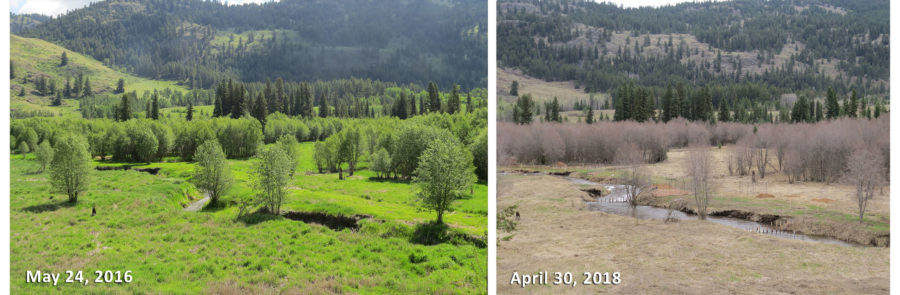
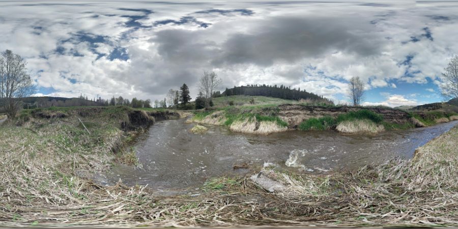
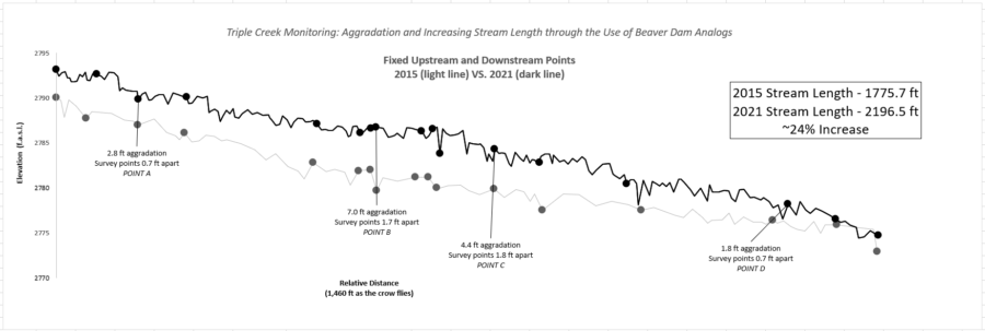
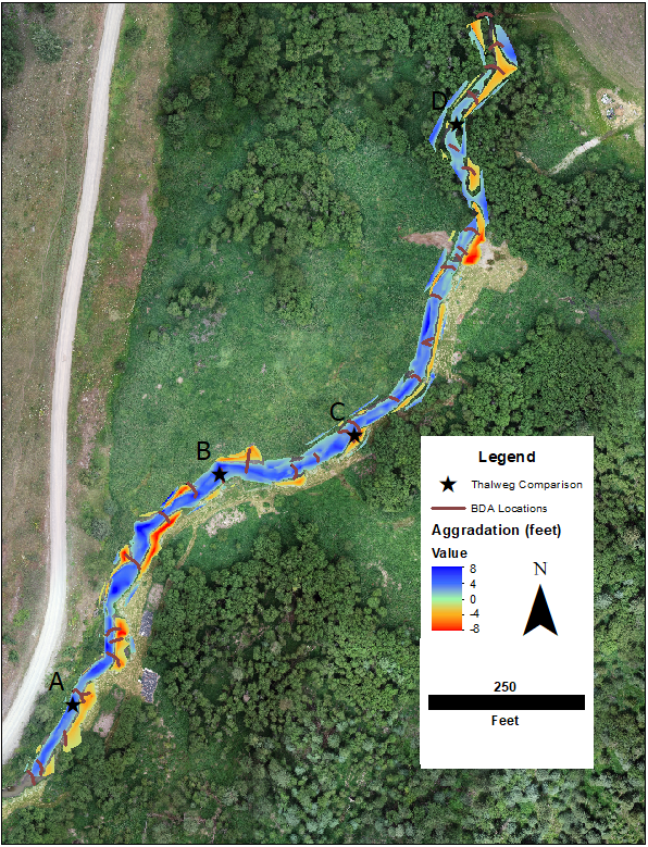
Topographic Survey Shows Progress at Triple Creek

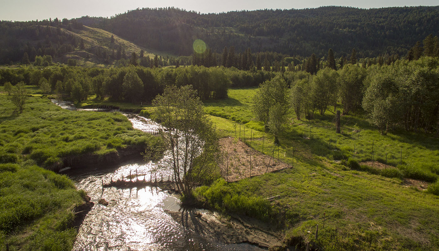
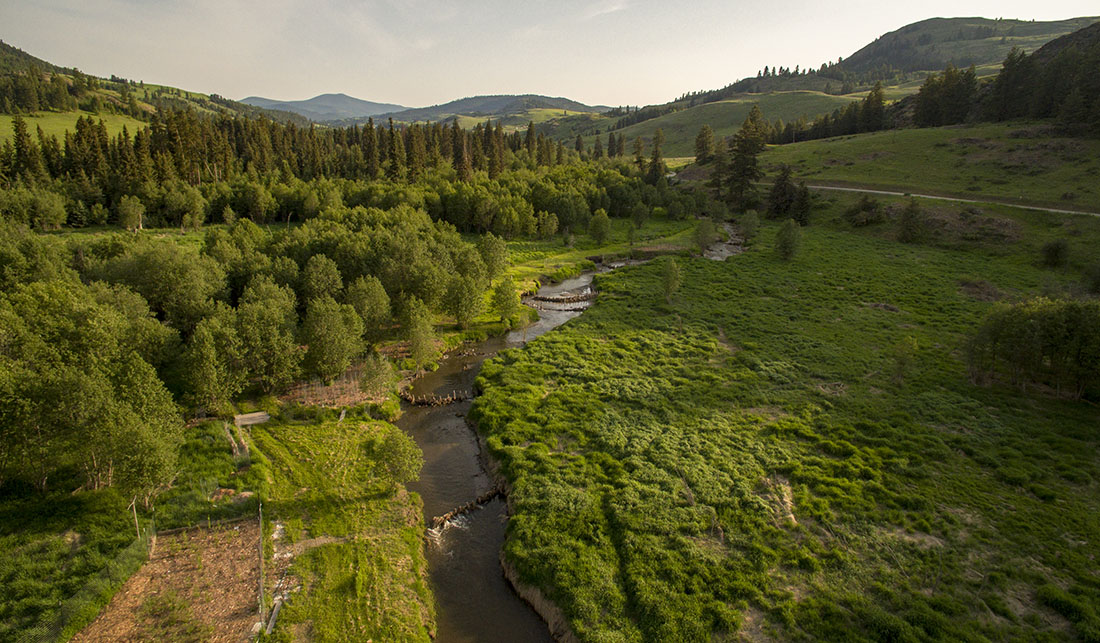
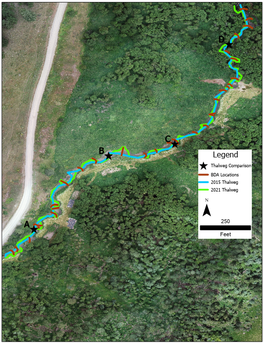
OHA partners with US Fish and Wildlife Service to conduct topographic surveys of the stream channel and banks to measure (even small) changes in elevation of the creek bed and shifts in the streambanks over time. The topographic surveys show how silt, sand, and gravels have accumulated, scoured, and moved throughout the project reach as the force of water carries the sediment downstream, recruits it from the streambanks, and deposits it on the creek bed. 

Graph above shows topographic survey (elevation data) plotted versus the relative distance in the thalweg of the stream. Points A-D on the graph are comparable to those points on the map below.
Aerial view (above) of Triple Creek Project area. Cooler colors signify aggradation and warmer colors signify erosion. Both processes are critical to the restoration of this stream and wetland.
The aerial view above shows that the reach is significantly longer and more sinuous now than it was before the project started.

Progress By The Numbers: 

  • 3800 yd3 = 271 dump trucks of sediment deposited in the reach!
  • 1500 yd3 = 107 dump trucks of sediment eroded in the reach!
  • 5300 yd3 = 378 dump trucks of sediment shifted within the reach!
  • 2300 yd3 = 164 dump trucks of sediment carried from outside the project area and deposited in the reach!

Landowners Support Beavers for Restoration

In 1980, a group of like-minded individuals purchased over 500 acres of land along Myers Creek north of Chesaw, on a site now known as Triple Creek. They formed an intentional community based on simple living and sustainable paths for securing food and shelter. Several households now live on this Okanogan Highlands landscape of forests, meadows, wetlands, and riparian areas. A primary goal of the community is improving and restoring wildlife habitat for native species. Members have developed a forest management plan, rehabilitated overgrazed pastures, and reduced noxious weeds, thus reestablishing native plants. By engaging with local non-profits and agencies for wetland restoration, the community is creating a legacy to benefit future generations…

Read more about the role of the land stewards and the development of this collaboration in this 2015 IRIS (Initiative for Rural Innovation & Stewardship) Success Supplement excerpt.

Wetland Protection in Upper Wauconda

LandownerCollaboration - OHA-OkanoganHighlandsAlliance-Restoration-LandownerSupport-LeeJohnson_PineCheeMaintenance.jpg

In November 2013, OHA approved an application for reimbursement for Wauconda landowner, Lee Johnson. Lee sought reimbursement for expenses for fences to protect a unique and exceptional wetland that he recently purchased.

Having lived adjacent to the wetland for over 30 years, Lee has built and maintained a fence that protects this resource, long before he actually purchased the wetland.

The protected area includes approximately 25 acres of wetland and forest fringe, laying north of Bunch Road at 4,000 feet elevation.

Continue reading

Birds

Raising the water level to the historic floodplain facilitates wildlife access to the creek!

Before & After

Our most recently installed planting plot in May 2019 was a joint effort from multiple partners!

Planting plots and stream, before and after construction
This terrace, or inset floodplain, will be planted with native riparian plants. 

Planting Plots

Ten planting plots on the upper floodplain (shown below in white and yellow) are being intensively managed for weed control and planted with native species appropriate for the drier soil hydrology. In addition, terraces, or inset floodplains within the incised channel (shown in green below) are being planted with native riparian species suited for the wetter soil conditions.

Click to enlarge

This riparian planting plot includes plants that tolerate a variety of hydrologic conditions, and the reed canarygrass and thistle are smothered with cardboard and bark.

These planting plots may someday provide willow and red osier dogwood for beaver, and spruce that can fall into the stream to improve structure and habitat in the channel.

BDAs at High Water

Beaver Dam Analogue (BDA) #8 was installed up against the incised banks of Myers Creek. During high water of spring 2017, the stream pushed its force around the BDA and into the bank, widening and lengthening the channel as needed. This sediment was then carried downstream, where it was captured by other BDAs and settled on the streambed. As a result, the streambed is now closer to its floodplain!

The ultimate goal of this project is to reconnect the stream with its floodplain, and foster the ecological benefits associated with that connection. The following video is taken at the upstream end of the structures that our team installed in the summer of 2016.

Below you can see that large wood is changing the movement of the stream, causing it to spill out over its banks and inundate the floodplain in a broad area on both sides of the creek. This is the least incised portion of the project area, and thus the first to reconnect. It is very exciting to see this degree of success during the first high flows after in-stream construction.

  • 1
  • 2
Go Back