Tag: wetlands

World Wetlands Day 2019

Wetlands around the world protect communities while helping fight climate change

As the world grapples with climate change, those commemorating World Wetlands Day Feb. 2 are highlighting the importance of restoring, conserving, and wisely using wetlands because they can help reduce floods, relieve droughts, and buffer coastlines from extreme weather.

In the state of Washington, we work every day to protect and manage wetlands. The environmental and economic benefits they provide nature, our communities, and way of life are immeasurable…

To help celebrate World Wetlands Day, the WA State Department of Ecology selected the Triple Creek project to feature on their blog. Click here to read the full article.

Landowners Support Beavers for Restoration

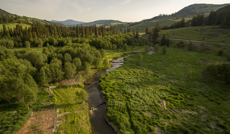
In 1980, a group of like-minded individuals purchased over 500 acres of land along Myers Creek north of Chesaw, on a site now known as Triple Creek. They formed an intentional community based on simple living and sustainable paths for securing food and shelter. Several households now live on this Okanogan Highlands landscape of forests, meadows, wetlands, and riparian areas. A primary goal of the community is improving and restoring wildlife habitat for native species. Members have developed a forest management plan, rehabilitated overgrazed pastures, and reduced noxious weeds, thus reestablishing native plants. By engaging with local non-profits and agencies for wetland restoration, the community is creating a legacy to benefit future generations…

Read more about the role of the land stewards and the development of this collaboration in this 2015 IRIS (Initiative for Rural Innovation & Stewardship) Success Supplement excerpt.

Wetland Protection in Upper Wauconda

LandownerCollaboration - OHA-OkanoganHighlandsAlliance-Restoration-LandownerSupport-LeeJohnson_PineCheeMaintenance.jpg

In November 2013, OHA approved an application for reimbursement for Wauconda landowner, Lee Johnson. Lee sought reimbursement for expenses for fences to protect a unique and exceptional wetland that he recently purchased.

Having lived adjacent to the wetland for over 30 years, Lee has built and maintained a fence that protects this resource, long before he actually purchased the wetland.

The protected area includes approximately 25 acres of wetland and forest fringe, laying north of Bunch Road at 4,000 feet elevation.

Continue reading

The Wetlands

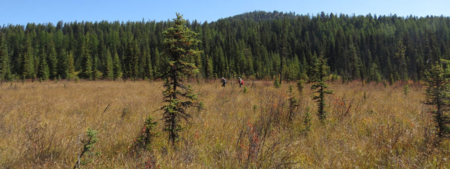
Channel at south end of Lost Lake wetland, impounded by beaver and storing much more water than in previous years, September 2015 (botanist George Thornton on the right)

Click here to view our full photo album of the Lost Lake wetlands year-round!

The Lost Lake calcareous fen, unusual for its almost neutral pH, creates conditions for a unique community of plants.

“The wetlands within the Lost Lake Preserve are of high conservation value due to the rare plants and plant communities which occur there and the fact that the site retains excellent ecological integrity despite numerous human stressors in the surrounding landscape. The site supports numerous wetland types such as a calcareous fen, shrub swamp, and forested seepage swamp. Of particular interest is the calcareous fen, which are rare in Washington and are primarily limited to the northeast corner of the State. Calcareous fens are also one of the rarest wetland types in the United States. Calcareous fens differ from other peatlands in that their pH is circumneutral to alkaline and they typically have a high amount of calcium and other base cations. Such conditions result in a unique set of plants which are able to grow in the fen. One of the more significant plant community types found at Lost Lake Preserve is the bog birch/slender sedge (Betula glandulosa/Carex lasiocarpa) plant association. This plant association is typically found in rich to extremely rich fens (e.g. calcareous fens) and is known to occur in northwestern Montana through northern Idaho and into northeastern Washington. Within Washington it is considered to be very rare. In summary, the Lost Lake Wetland Preserve harbors some significant pieces of Washington’s natural heritage. The long-term protection of this wetland complex would contribute to the conservation of these biodiversity treasures within Washington state.”

Joe Rocchio, WA Dept. of Natural Resources

Plant of Interest: Carnivorous Bladderwort

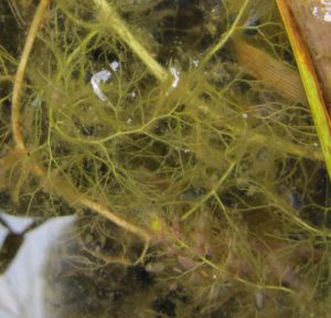
Bladderwort underwater

Interesting changes in the plant community are occurring as a result of increasing areas of deep standing water from beaver dams. The bog birch is dying out where beaver ponds have been developed. In place of the bog birch, vast networks of Common Bladderwort (Ultricularia vulgaris) are thriving.

The name “Common” Bladderwort isn’t a very good descriptor for a plant with highly unique capabilities…

Continue reading

Planting Plots

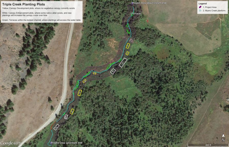
Ten planting plots on the upper floodplain (shown below in white and yellow) are being intensively managed for weed control and planted with native species appropriate for the drier soil hydrology. In addition, terraces, or inset floodplains within the incised channel (shown in green below) are being planted with native riparian species suited for the wetter soil conditions.

Click to enlarge

This riparian planting plot includes plants that tolerate a variety of hydrologic conditions, and the reed canarygrass and thistle are smothered with cardboard and bark.

These planting plots may someday provide willow and red osier dogwood for beaver, and spruce that can fall into the stream to improve structure and habitat in the channel.

BDAs at High Water

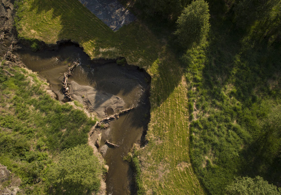
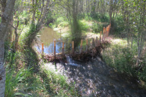
Beaver Dam Analogue (BDA) #8 was installed up against the incised banks of Myers Creek. During high water of spring 2017, the stream pushed its force around the BDA and into the bank, widening and lengthening the channel as needed. This sediment was then carried downstream, where it was captured by other BDAs and settled on the streambed. As a result, the streambed is now closer to its floodplain!

The ultimate goal of this project is to reconnect the stream with its floodplain, and foster the ecological benefits associated with that connection. The following video is taken at the upstream end of the structures that our team installed in the summer of 2016.

Below you can see that large wood is changing the movement of the stream, causing it to spill out over its banks and inundate the floodplain in a broad area on both sides of the creek. This is the least incised portion of the project area, and thus the first to reconnect. It is very exciting to see this degree of success during the first high flows after in-stream construction.

Deflector Dams: Bird’s-Eye View

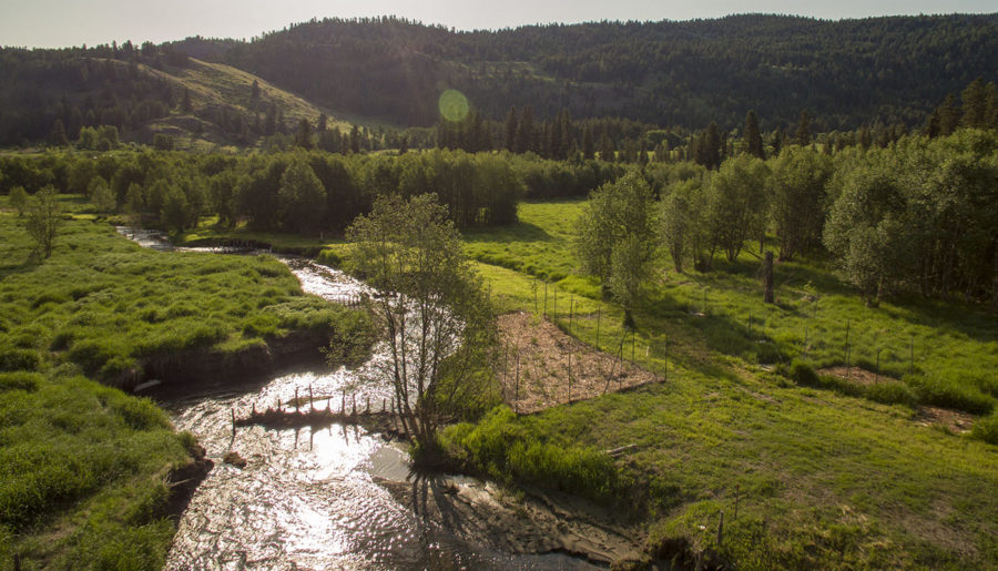
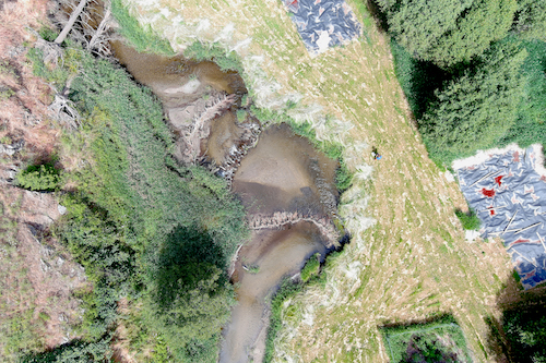
A deflector dam (2018) pushes the stream against the bank to lengthen and widen the channel and recruit sediment for building the streambed higher.

The same view, 2 years later (2020).

Collaborative Team Works to Restore Wetland

On the western toe of Buckhorn Mountain, in a place called Triple Creek, a rich wetland once thrived. A productive great blue heron rookery overlooked large beaver ponds teeming with trout. Myers Creek spilled over its banks, keeping the soils wet so that animals from all levels of life could flourish – from dragonflies to frogs to birds of prey. In the late 1990’s, an unusually heavy rain-on-snow event changed everything…

Click here for the full article in the Okanogan Valley Gazette-Tribune

  • 1
  • 2
Go Back